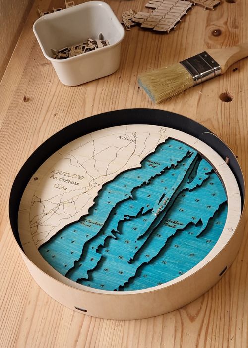

Ireland has over 12,000 lakes scattered across every county on the island. These are the five lakes that have captured our attention either through design, the stories around them, or just ones that sound like they are worth a visit. We haven't made it to all of them yet, but its a good excuse for an adventure next summer!
For us the best lakes tend to offer more than scenery. They sit inside national parks or areas of outstanding natural beauty, they carry layers of human history; monastic ruins, Viking trails, Bronze Age copper mines, and they're steeped in the kind of mythology that is just on the edge of reality, that makes your hair tingle a little as you know it sits just across the thin veil between our worlds.
1. Lough Leane, Killarney, Co. Kerry
From our medium Killarney National Park map, Lough Leane is Ireland's most visited lake. It's surrounded by the MacGillycuddy Reeks mountain range, fringed with ancient oak woodland, and watched over by a 15th-century tower house. The lake covers 19 square kilometres and is the largest of Killarney's three lakes, the others being Muckross and the Upper Lake. White-tailed eagles, reintroduced to Kerry in the early 2000s, are frequently spotted from the water, along with Killarneys famous Red Deer grazing at the waters edge.
The geology of Lough Leane
The lakes of Killarney were carved out during the last Ice Age. As the glaciers retreated, they left behind deep rock basins that filled with exceptionally clear water. The surrounding MacGillycuddy's Reeks are made of Old Red Sandstone, some of the oldest rocks in Ireland at over 350 million years old, give the mountains their warm reddish glow at sunrise and sunset. Ross Island, on the lake's eastern shore, sits above one of Ireland's richest copper deposits. Bronze Age people were mining copper here as far back as 2400 BC, making it the earliest copper mine in all of Ireland and the British Isles. Copper from this mine was traded has been traced to Wales and Scotland.
The mythology of Lough Leane
According to Irish legend, beneath the waters of Lough Leane lies Tír na nÓg, the Land of Eternal Youth. The story tells of Oisín, warrior-poet and son of the great Fionn Mac Cumhaill, who was riding along the lake's shore when he encountered the goddess Niamh of the Golden Hair. She carried him across the water to her otherworldly realm, where he lived for what felt like three years. When he returned to Ireland, three hundred years had passed. Warned not to touch Irish soil, he fell from his horse while helping workmen lift a stone, and every one of those three centuries rushed back through his body in an instant.
Ross Castle carries its own haunting legend. According to tradition, the ghost of the old clan chief O'Donoghue, still sleeps beneath the lake's surface. On the first morning of May, every seven years, he rises on a white horse and circles the lake. Anyone who sees him, the legend promises, will be blessed with good fortune for the rest of their days.
The history of Lough Leane
Innisfallen Island, floating quietly in the heart of the lake, was home to a monastery founded in 640 AD. For more than 900 years it was continuously occupied, making it one of the most enduring centres of religious life in medieval Ireland. Between the 11th and 13th centuries, 39 monks collaborated here on the Annals of Innisfallen, one of the most important chronicles of early Irish history, written in a mixture of Irish and Latin. Those annals are now held in the Bodleian Library in Oxford. The monastery is also said to have educated Brian Boru, the High King who united Ireland and defeated the Vikings at the Battle of Clontarf in 1014.
2. Glendalough, Co. Wicklow
Glendalough means "valley of the two lakes" in Irish, and the name barely does it justice. Set deep in the Wicklow Mountains National Park, about 90 minutes south of Dublin, it's routinely ranked as one of the top day trips in all of Ireland and one of the most beautiful natural settings in the country. The Upper Lake is the one that stops people in their tracks, enclosed on three sides by granite cliffs, fed by mountain waterfalls, and still enough on calm days to reflect the sky like a mirror.
The combination of two glacial lakes, a complete early medieval monastic city, a 1,000-year-old Round Tower, and some of the finest mountain walking on the East Coast makes Glendalough genuinely difficult to match anywhere in Ireland. Glendalough nestles in our Wicklow Mountains map, tucked into a fold of the mountains.
The geology of Glendalough
The Wicklow Mountains were formed around 420 million years ago when a huge mass of molten granite pushed up through older, softer rocks and slowly cooled underground. Over hundreds of millions of years, the softer rock above eroded away to expose the granite we see today. During the last Ice Age, glaciers carved through the valley, creating the elongated depression that geologists call a ribbon lake; long, narrow, and deep, formed in a glacial trough. The Upper Lake sits 130 metres above sea level, fed by waterfalls off Camaderry mountain. The granite of Glendalough is among the hardest rock in Ireland, which gives the valley such drama
The mythology of Glendalough
St Kevin, who founded the monastery here in the late 6th century, is one of the great eccentric figures of early Irish Christianity. He came to Glendalough seeking absolute solitude, living in a tiny cave, still called St Kevin's Bed, cut into a cliff face 30 feet above the Upper Lake and reachable only by boat or a dangerously narrow ledge. One of the most famous legends of Irish monasticism tells that Kevin stood for forty days in the lake, waist-deep in freezing water, arms outstretched in prayer, utterly motionless until a blackbird landed in his open palm and laid her eggs. He remained still, arms aching, until the eggs hatched. The image of this man holding his patience above the icy water while the world moved around him became one of the defining symbols of Irish spiritual devotion.
The history of Glendalough
The monastery St Kevin founded grew into one of the great centres of learning in medieval Europe, part of the extraordinary flowering of Irish Christianity that earned the island its title "Island of Saints and Scholars." While much of Europe descended into chaos after the fall of the Roman Empire, Irish monks preserved classical literature, produced illuminated manuscripts, and sent missionaries across the continent. Glendalough was raided by Vikings multiple times in 775, 836, and 1000 AD, but each time, the monks returned. The Round Tower, which still stands at the site, may have served as a watchtower: when Viking longships were spotted on nearby rivers, monks could climb inside, pull the ladder up behind them, and shelter with their treasures until the raiders had passed.
3. Lough Corrib, Co. Galway
Lough Corrib is the largest lake in the Republic of Ireland and the second largest on the island as a whole, covering 176 square kilometres. It stretches from the edge of Galway City northward into the breathtaking landscape of Connemara, and it contains over 365 islands, one for every day of the year, according to local tradition. It is a Ramsar Wetland Site, a Special Area of Conservation, and one of the most important angling lakes in Europe. It's such a special place we have this as a medium as well as one of our round Local Spots maps.
The geology of Lough Corrib
Lough Corrib sits on a broad limestone basin, the same limestone that forms the remarkable Burren landscape in County Clare. The rock is riddled with karst features: sinkholes, underground rivers, and cave systems that mean water moves through the landscape in ways you can't always predict or see. In places along the lake's shores, rivers disappear underground and re-emerge kilometres away. The lake is shallower and calmer in the south, where the limestone dominates, and deeper and more dramatic in the north, where the geology shifts to the ancient Connemara rocks that form the mountainous backdrop. Ireland's first canal was built here right back in the 12th century to allow boats to pass between the lake and Galway Bay — making Lough Corrib the starting point of Irish canal history.
The mythology of Lough Corrib
The lake is said to be haunted by the Each Uisge - the water horse - one of the darkest creatures in Irish folklore. It appears on the shore in the form of a magnificent, irresistible horse. Any traveller who climbs onto its back finds they cannot dismount, as the creature gallops into the lake and drags them to the bottom. Inchagoill Island holds the Stone of Luguaedon, a pillar stone bearing inscriptions in the ancient ogham alphabet and early Latin. It carries some of the oldest Christian inscriptions found outside of Rome.
The history of Lough Corrib
Ashford Castle, now a luxury hotel, was built on the northern shore of the lake by the Anglo-Norman de Burgo family in 1228, and was later extended by the Guinness family in the 19th century. The lake itself has been a premier salmon and trout fishery for centuries. Every May, the emergence of the mayfly brings a brief, intense season when vast numbers of trout rise to the surface to feed. Anglers from across Europe descend on Oughterard and the lake's western shore for what locals call "the mayfly madness", a tradition of fishing, late evenings, and lively pub sessions that has been going strong for well over a hundred years. Cong village also sits on the lakes northern edge, made famous by the 1952 John Ford film The Quiet Man and still a destination for film fanatics to this day.
4. Lough Neagh, Northern Ireland
Lough Neagh is in a category entirely its own. The largest freshwater lake in Ireland. England, Scotland, or Wales - it covers 383 square kilometres, stretches 32 kilometres in length, and touches five of the six counties of Northern Ireland. It supplies over 40% of Northern Ireland's drinking water, supports one of the most important bird sanctuaries in northwest Europe, and was, according to legend, created in a single moment by the giant Fionn Mac Cumhaill.
The geology of Lough Neagh
The geology of Lough Neagh is as dramatic as any of its legends. Scientists believe the lake occupies a pull-apart basin, a zone where the earth's crust stretched and rifted apart over millions of years. Around 40 to 60 million years ago, the same volcanic episode that created the Giant's Causeway on the Antrim coast caused massive volumes of basalt rock to pour across the landscape. Over time, the land subsided under the weight of that rock, creating an enormous natural depression that filled with water. Ancient human remains and artefacts found at Toome Bay on the lake's northwestern shore are the oldest ever discovered in Ireland, evidence that people have been living on these shores since the very earliest days of human settlement on the island.
The mythology of Lough Neagh
The most famous legend of the lake's creation involves Fionn Mac Cumhaill, the great giant of Irish mythology. While taunting a Scottish rival giant Benandonner, Fionn scooped up a fistful of earth from the north of Ireland and hurled it across the sea. The earth missed its target, landed in the Irish Sea, and became the Isle of Man. The massive crater left behind filled with water and became Lough Neagh. This legend also connects to the Giant's Causeway to the isle of Scaffa in Scotland, Fionn built those stepping stones to reach Scotland and fight the Scottish giant.
The history of Lough Neagh
In 839 AD, a fleet of Viking longships made Lough Neagh their winter base, using its vast, sheltered waters to launch raids across Ulster. The lake is also famous for one of the largest eel fisheries in Europe. The European eel is born in the Sargasso Sea near Bermuda and swims over 6,000 kilometres across the Atlantic to reach Irish fresh water, where it can live for decades before returning to the Sargasso to spawn and die. The eels of Lough Neagh have been fished commercially for centuries, and the tradition of eel fishing here is ancient, deeply rooted, and still ongoing.
5. Lough Derg, Co. Tipperary
Lough Derg is Ireland's third-largest lake at over 130 square kilometres. The lake has a coastline of 179 kilometres, much longer than you'd expect, taking in dramatic escarpments, sandy coves, ancient monastic ruins, waterside villages, and some of the most genuinely welcoming pubs in Ireland. Our Lough Derg round map is one of our most popular, telling of the draw this lake has to so many.
The geology of Lough Derg
Lough Derg sits at the southern end of the River Shannon's journey through the Irish midlands. In certain lights the water takes on a faint milky-blue tint, caused by fine calcium carbonate particles suspended in the water. The hills rising around the lake are truely ancient: Devonian sandstone formed over 400 million years ago, when this part of the world sat just south of the equator. The lake's long and irregular 179-kilometre coastline is the result of a heavily scoured, glacially shaped shoreline full of sheltered bays, inlets, and hidden coves, each with its own microclimate and character.
The mythology of Lough Derg
The name Derg comes from the Old Irish word dearg, meaning red. According to legend, the lake takes its name from Eochaid Derg, a High King of Ireland who lost an eye in battle on the lake's shores, turning the waters crimson. Like Lough Corrib above, Lough Derg is also said to be haunted by the Each Uisge, the shape-shifting water horse that lures unwary travellers beneath the surface. Every bay and island on the lake carries a name rooted in early Irish storytelling, and the surrounding landscape, dense with ringforts, early medieval churches, and holy wells making this one of the most significant inhabited landscapes in early Ireland.
The history of Lough Derg
In the 9th century, Viking longships sailed up the River Shannon and onto Lough Derg, targeting the wealthy monasteries at Terryglass and Lorrha on the Tipperary shore. The Vikings came for gold and left fire in their wake, but the monks rebuilt. The ruins of the ancient church at Terryglass still stand in the village churchyard today, within walking distance of the waterside pub where visitors now sit with a pint and watch the evening light move across the water. The Lough Derg Blueway, a marked walking and paddling trail along the Tipperary shore, follows a water highway that has been in use, in one form or another, since the stone age.
Of the other lakes we've written about — Lough Ree, Lough Gill, Lough Melvin, — each is beautiful and worth visiting. Our very own Lough Gill in Sligo, with its connection to W.B. Yeats and the Isle of Innisfree, is a genuine rival for a top-five spot and appears on many hidden gem lists, but in terms of visitors, legends and popularity, this is the top 5 in Ireland!
Quiz night questions on Irelands lakes!
What is the largest lake in Ireland?
Lough Neagh in Northern Ireland is the largest lake in Ireland and in the British Isles, covering 383 square kilometres.
What is the largest lake in the Republic of Ireland?
Lough Corrib in County Galway is the largest lake in the Republic of Ireland, covering 176 square kilometres.
What is the deepest lake in Ireland?
Muckross Lake in Killarney National Park, County Kerry, is the deepest lake in Ireland at 75 metres deep.
What is the most visited lake in Ireland?
Lough Leane in Killarney, County Kerry, is consistently ranked as the most visited lake in Ireland, drawing hundreds of thousands of visitors each year to Killarney National Park.
Can you swim in Ireland's lakes?
Swimming is possible in many of Ireland's lakes. Lough Derg has designated blue flag beaches suitable for swimming in summer. Always check local conditions and signage before entering the water.
What is the best time to visit Ireland's lakes?
Late spring to early autumn — May through September — offers the best combination of weather, light, and long evenings for exploring Ireland's lakes. Autumn is particularly spectacular for colour and atmosphere.