Outcrop design
Roches Point 3d map medium
Frame colour:Black frame
Quantity:
Choose options
Frame colour:Black frame
Quantity:
Frame colour:Black frame
Quantity:
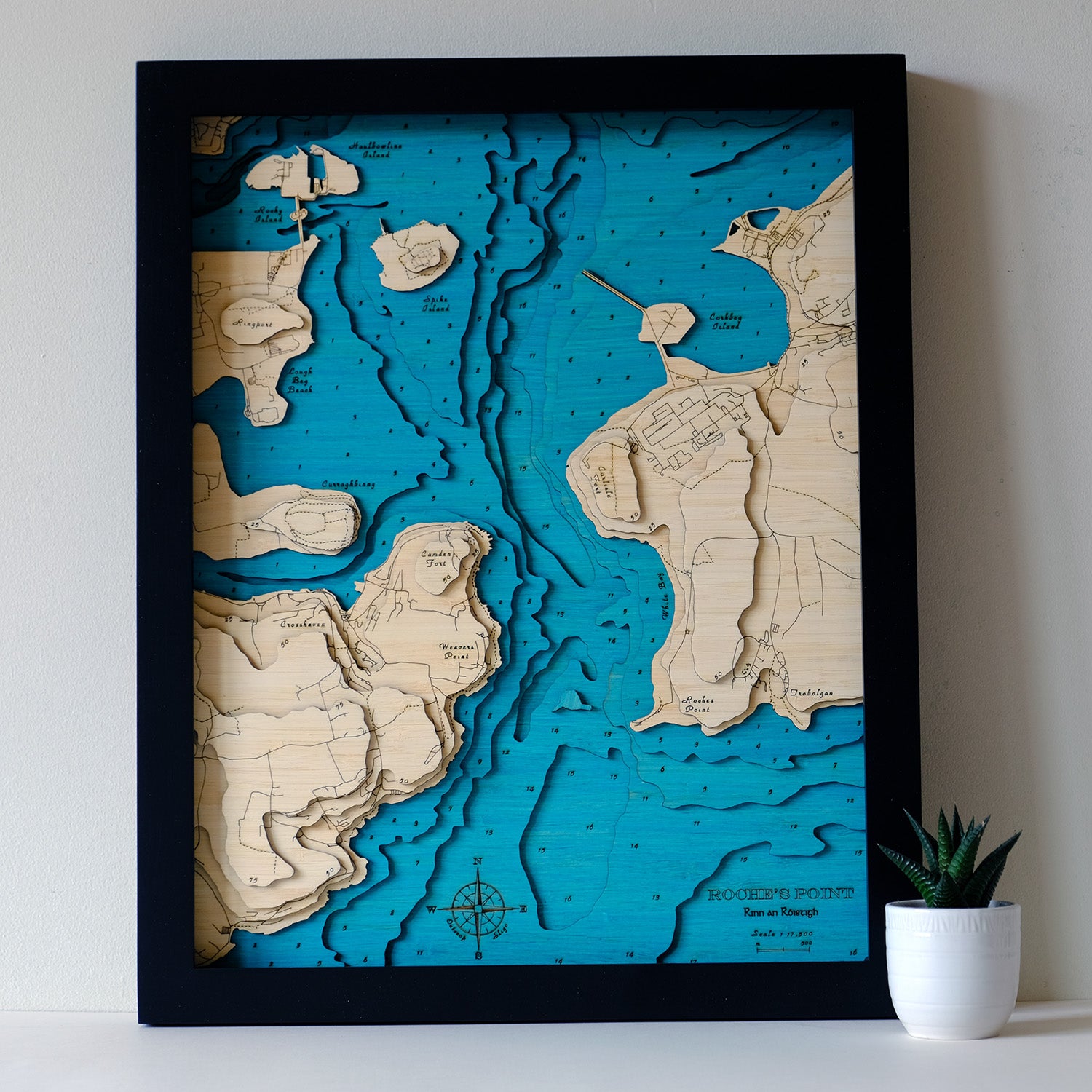
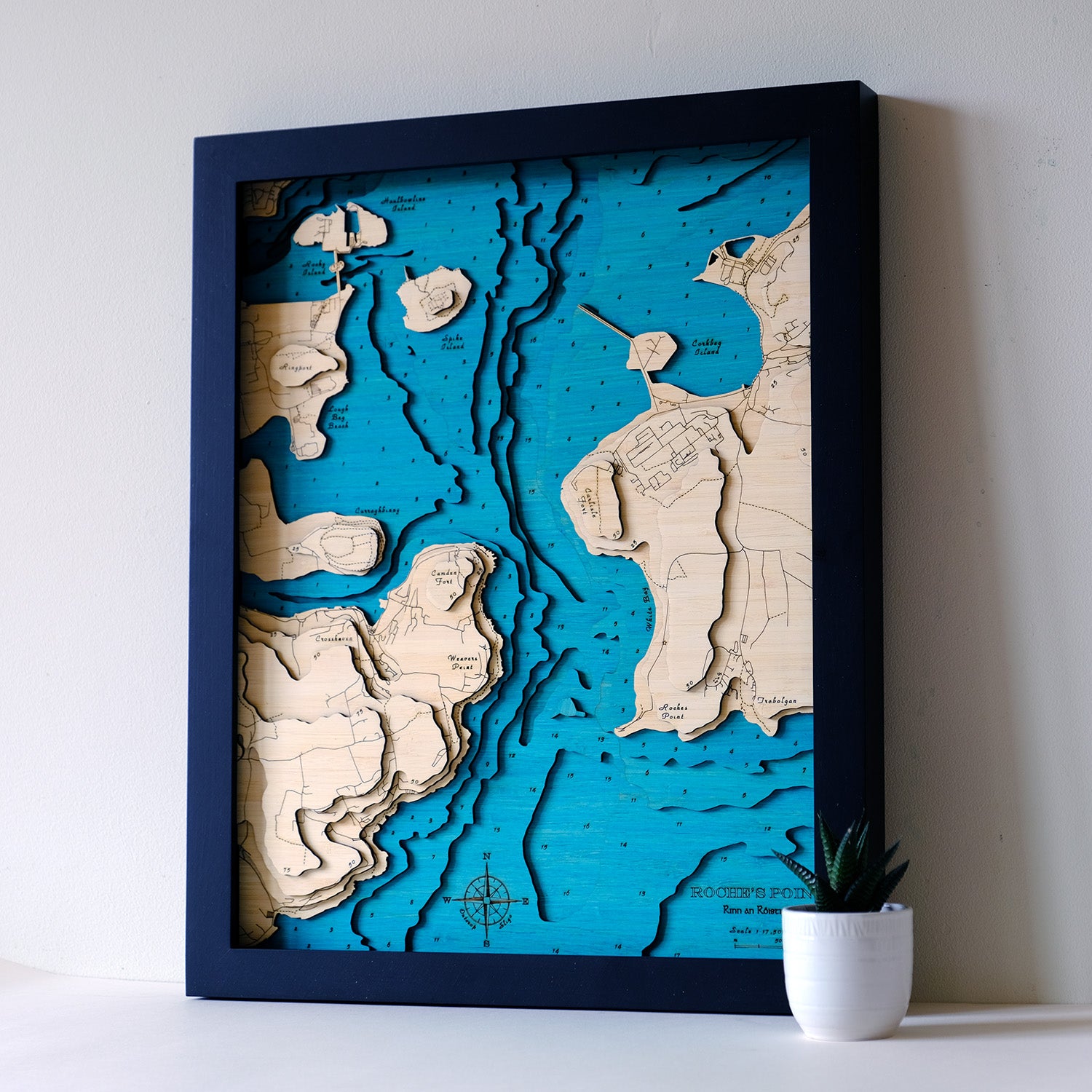
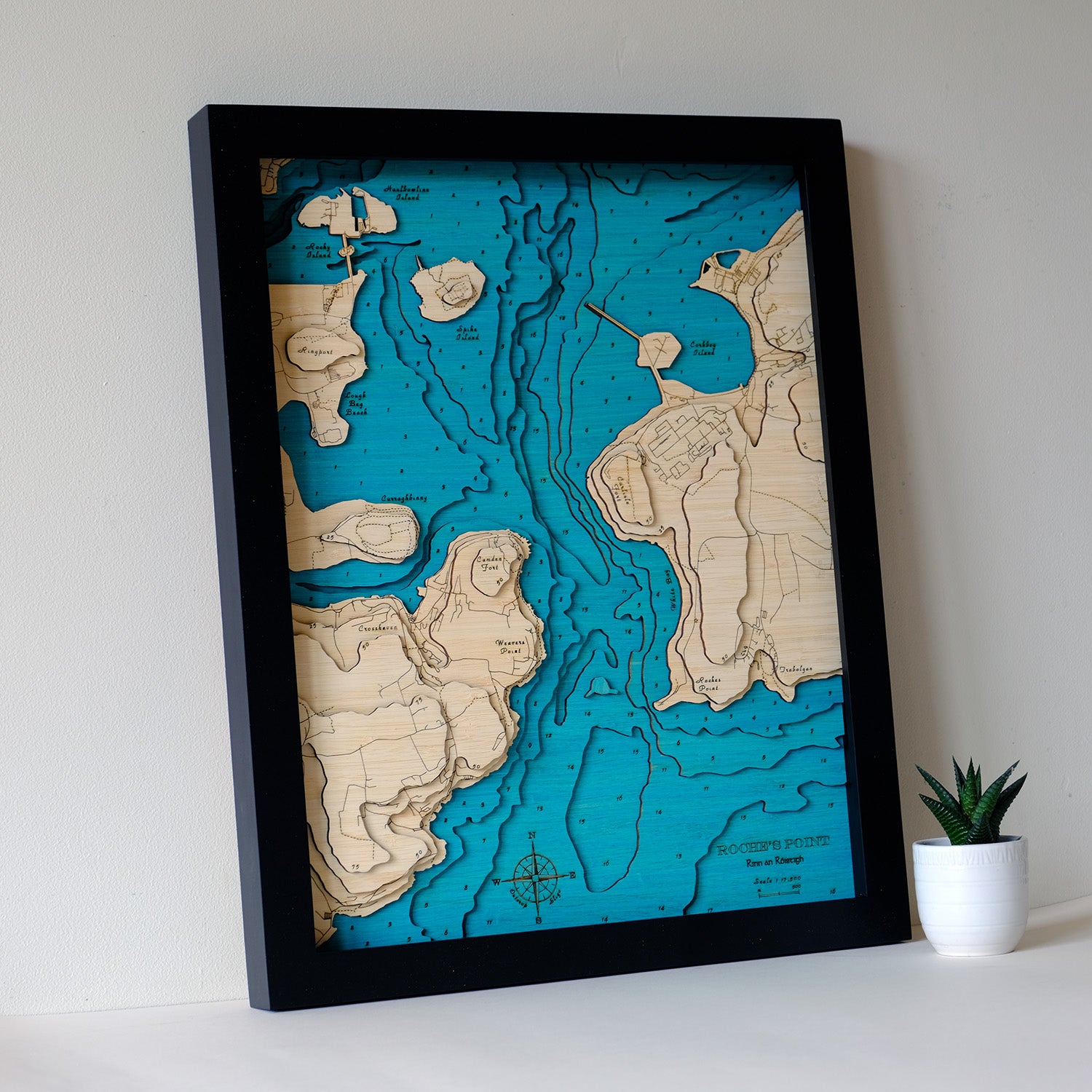
ROCHES POINT, CO. CORK, IRELAND
Rinn an Róistigh
Medium Size 3d Art Maps
The dramatic entrance to Cork harbour, guarded by the twin forts of Camden and Carlisle. Forming the mouth of the River Lee, Cork harbour is considered the second largest natural harbour in the world (along with Halifax, Trinconmalee and Poole).
Haulbowline Island is the birthplace of the Royal Cork Yacht Club, the oldest yacht club in the world. They are now based in Crosshaven, also shown on this map.
Areas Covered
- Roches Point
- Trabolgan
- White Bay
- Carlisle and Camden Forts
- Corkbeg Island
- Haulbowline, Spike and Rocky Islands
- Ringport
- Lough Beg Beach
- Curraghbinny
- Crosshaven
- Weavers Point
Roads shown in full detail, with tracks as well.